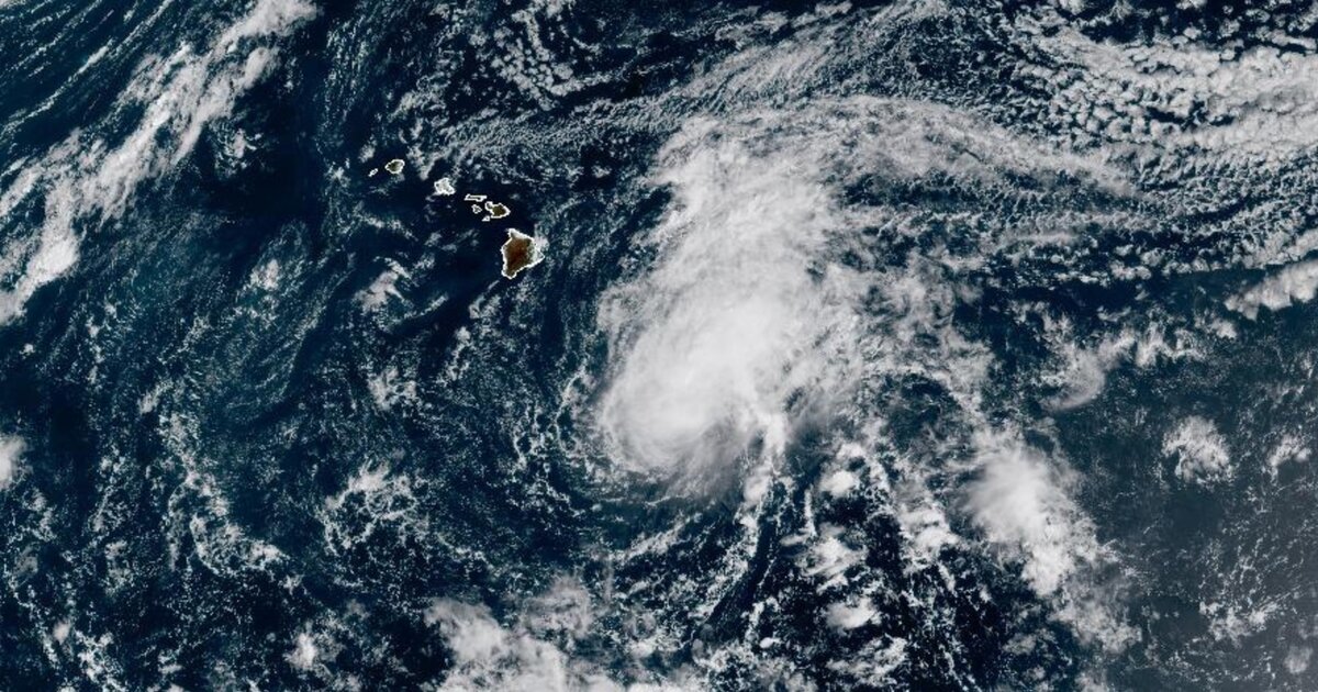
Tropical Storm Moke is expected to deliver heavy rainfall and gusty winds this weekend as it skirts just south of the Hawaiian Islands in the wake of serious damage delivered by Hurricane Lala.Moke packed maximum sustained winds of 50 mph as of midday Saturday and was expected to strengthen throughout the day, according to the National Hurricane Center. The storm is not expected to make landfall in Hawaii, but will still deliver rain and wind to the Big Island on Saturday night and early Sunday and then the other islands early next week."This rainfall may produce life-threatening flooding and mudslides for the windward and southeast Big Island, especially in steep terrain and over areas that were affected recently by Lala," according to the National Hurricane Center.The islands, especially the Big Island, were hit very hard by Hurricane Lala just last weekend. A hurricane hasn\u0027t made direct landfall in the state since Iniki in 1992, but the eye of the then-Category 1 Hurricane Lala passed just 30 miles off the Big Island\u0027s coast, bringing wind gusts over 80 mph and torrential rain, with some areas seeing more than 3 feet. Kapalua, located in Maui County, was hit with 48 inches of rain over the weekend.\u00a0The rainfall totals from Moke won\u0027t be as high, but will still be dangerous, especially in conjunction with the already saturated ground. Rainfall totals across the hard-hit Big Island will span 5 to 10 inches with up to 15 inches in some locations, according to the National Hurricane Center. Eastern Maui, the second-largest of the islands, will receive 1 to 2 inches on average, with some places on the island seeing up to 4 inches.Hawaii activated its joint information center on Saturday, just days after deactivating its center for Lala. The information center is responsible for coordinating updates for the public from the Hawaii Emergency Management Agency.The islands are paying a price from an El Ni\u00f1o climate pattern, via warming waters in the eastern Pacific Ocean. Warm ocean waters are the essential fuel for tropical cyclone development, which makes this El Ni\u00f1o phase perfect conditions for an increased hurricane season in the region.Because it reduces vertical wind shear, meaning change in direction of winds at higher levels of the atmosphere, an El Ni\u00f1o climate pattern allows for tropical systems that develop in the region to avoid getting "blown over" and falling apart.